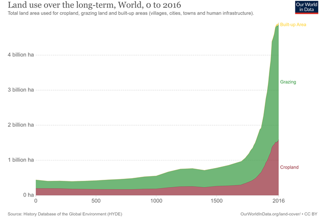
The visualization shows long-term human (anthropogenic) land use since 10,000 BC till 2016. It details the change in total used for cropland, grazing land and built-up/urban area (villages, cities, towns and human infrastructure) in hectares.
Another shows that 10% of the world is covered by glaciers and 19% is barren land – deserts, dry salt flats, beaches, sand dunes, and exposed rocks. The remainder is habitable land, half of which is used for agriculture.
Of the habitable land, 37% is forests, 11% shrubs and grasslands, 1% freshwater coverage, and the remaining 1% is built-up/urban area, which would fit into an area the size of Libya.

